The West Highland Way is an icon of Scottish hiking. Not the most challenging of routes underfoot, with little elevation, it makes for a great introduction to multi-day hikes (‘though-hikes’), and can be rewarding for hikers of all levels. What follows is all the information that I wish I had before I set off!
Jump to…
The Route
The route is around 96 miles / 155 km, and can be completed (walking) in anything from four days. Most people will take about 7-10 days. The route is usually hiked south-to-north (with the option to do Ben Nevis the day after you finish), so that’s the itinerary we’ll follow here.
The West Highland Way starts on the outskirts of Glasgow, in Milngavie (pronounced mill-guy), and heads through a few towns on its mostly rural way north to Fort William. Paths underfoot are all well-maintained and well-signed (don’t try – but you could probably get away without a map…). We’ve broken the route down into a few main waypoints, and go through each in sequence.
Main Waypoints
There are a few towns and villages en-route, which can be useful to resupply – or just enjoy a pub meal.
1. Milngavie
Milngavie is well-stocked with shops, cafés etc. for a pre-hike refresher, and has a free water fill-up point.
2. Drymen
Drymen has another free water tap, a relatively well-stocked Spar, and several pubs and cafés
3. Balmaha
Balmaha has a small ‘village shop’ for restocking on snacks, a public toilet, water refill and a pub.
4. Rowardennan
Rowardennan has a pub, hotel and a water refill point.
5. Inversnaid
Inversnaid has a water refill tap, a hotel and some benches.
6. Inverarnan and Beniglas
Inverarnan is slightly off-route, and has a pub. Directly en-route, Beniglas campsite has water refill taps, toilets and a café.
7. Tyndrum
Tyndrum has a couple of good shops for resupply (I used the KeyStore), as well as lots of opportunities for food and water. The Ben Lui restaurant is open the latest (food till 9pm) for late arrivals, but for The Real Food Café takes the top spot.
8. Inveroran
Inveroran is essentially just a pub, with a small shop (they will open it for you if it’s shut when you arrive). They also have toilets and a water refill point.
9. Kingshouse
Kingshouse is a large hotel but has public toilets and showers (take some spare change for the showers), water refill, and plenty of excellent wildcamping spots.
10. Kinlochleven
Kinlochleven is one of the bigger towns we pass, with cafés, pubs and a campsite.
11. Fort William
Fort William has a lovely high street, with everything you could possibly need. Try the Black Isle Bar right at the finish for great pizza and beer. Free water refills in town, along with enough outdoor shops to keep you entertained all day.
Segment Descriptions
I’ve broken the route down into 9 segments (between each of the waypoints discussed above). I dont necessarily suggest walking each as a separate day – you can see the distances and points on a map with the button below, and use it do plan your own days.
1. Milngavie to Drymen – 19 km
Probably the least interesting section of the West Highland Way is also the first. The route starts off in a picturesque woodland path by a stream before leaving the wood for a gravel track that then gives way to an abandoned railway line. Fast walking, but not great on the feet. The route passes the outskirts of Drymen.
2. Drymen to Balmaha – 11 km
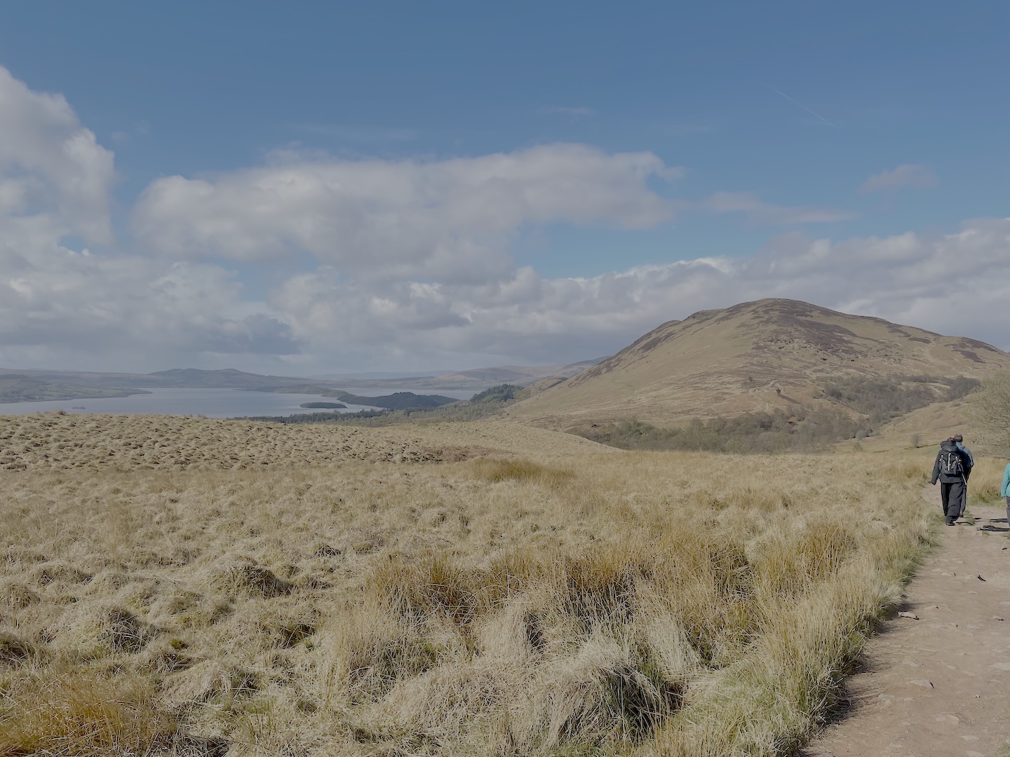
As you pass Drymen (or as you leave it if you went into the town), the route takes you into a large spruce plantation, with plenty of wildcamping spots. After a few kilometres, you leave the plantation and the ground opens up for even better camping. You then pass near the top of Conic Hill (it’s round a 60 m diversion to go to the summit and enjoy the view), and the rote descends into Balmaha. Welcome to Loch Lomond!
3. Balmaha to Rowardennan – 11 km
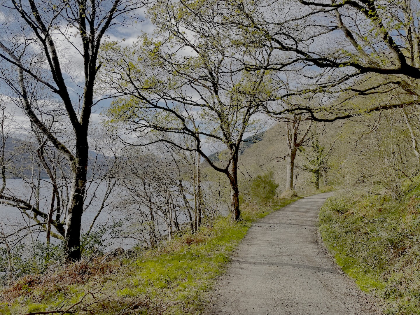
This section (and the next two) take you exclusively along the shores of Loch Lomond. It is beautiful walking, with fantastic views to the mountains on the other side and picturesque sunny (if you’re so lucky) views through the trees and down to the loch. Wild camping is prohibited for all of this section of the walk.
4. Rowardennan to Inversnaid – 12 km
Once again, wildcamping is prohibited. The walking is much the same as the above section.
5. Inversnaid to Inverarnan – 10 km
The Camping Management Zone ends just past Rowardennan (roughly opposite Firkin – it is clearly signed), so you’re allowed to wild camp after about the 2nd kilometre of this section There are also two bothies here (Rowchoish and Doune Byre). Terrain is much the same as the previous two sections, with some lovely beaches on the northern reaches of the loch. A few kilometres before the end of the segment you climb up and away from the lake, but walking into Beniglas campsite is straightforward.
6. Inverarnan to Tyndrum, passing Crianlarich – 18 km
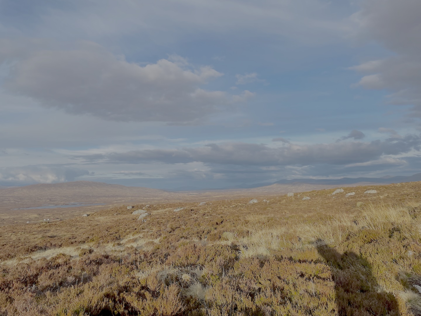
A relatively long segment, with its first half in Glen Falloch, shadowing the main road and railway line. Once you cross under the main road and walk for a time on the old road, the path begins to climb away from the road and into a recently-felled plantation. There’s a signpost with distances that marks the West Highland Way’s nearest point to Crianlarich – still around a kilometre. The path turns north-westwards at this point, and drops to again cross the A82. The walk in to Tyndrum from here can feel like a bit of a trudge, though a relatively flat and featureless (if beautiful) landscape of fields and plantations. The Holy Pool of St. Fillan makes for a great wild swimming spot.
7. Tyndrum to Inveroran – 15 km
Out of Tyndrum, the path again shadows the A83 for a few kilometres. It then diverges, with the path and railway keeping to the right of the valley and the road to the left. The path all the way to Bridge of Orchy is excellent, but you will feel it on the feet. There’s now a hill between you and Inveroran, which the path climbs and descends without ceremony. There’s a cairn at the highest point, with beautiful views over Loch Tulla.
8. Inveroran to Kingshouse – 16 km
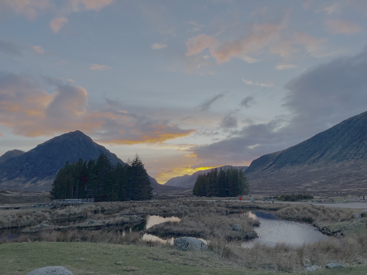
The path from Inveroran follows the road until Forest Lodge, and then is excellent (again with a consequence for the feet), so you can put on some good speed all the way to the Glencoe Mountain Resort (ski centre). Views across the wide open landscape you find yourself in are excellent, with plenty of opportunities to wildcamp. The path then begins to descend, with signs to the Mountain Resort to your left. You join the road at Blackrock Cottage, and crosss the A82 (again) on the way in to Kingshouse.
9. Kingshouse to Kinlochleven – 14 km
Even though we’re crossed the A82 for the last time, the path still follows it down Glen Coe for the first 4 kilometres of this segment. At a sharp bend in the road, we leave it to head northwards, and climb the Devil’s Staircase. Often touted as the toughest section of the walk, the Staircase won’t give experienced hikers any pause for thought – but do expect a steep section and some out-of-breath moments. Views in both directions from the pass at the top are spectacular. We now embark on probably the most picturesque section of the walk, which ends after only a few kilometres, where we meet the track alongside Kinlochleven’s hydro power penstock. The descent into Kinlochleven is not particularly interesting, and your feet will definitely know about it.
10. Kinlochleven to Fort William – 25 km
The largest section I describe here, there really are no intermediate settlements. If you want to break this section up you’ll need to wildcamp – or camp at Glen Nevis, but at that point you’re so close to the end that you might as well just do it… We ascend a picturesque valley out of Kinlochleven, and join a good track at the top which we’ll keep to for around 8-9 kilometres. The picturesque ruin at Tigh-na-sleubhaich, about halfway along the track, makes a great lunch spot. Getting off the track provides a welcome break for the feet, but you soon join the track that will take you all the way into Fort William. The track itself, which we pick up in a pass that leads into Glen Nevis, is unforgiving on the feet and lasts an implausibly long time. Just beyond where a lower track meets the main one, the West Highland Way leaves the forestry track and heads down into the glen. It then follows the road all the way into Fort William – again meeting our old friend the A82. From Fort William station, walk up the high street to the finish, and enjoy your achievement!
Planning
Before setting off on the West Highland Way you’ll need to decide on a few things. I’ll discuss what to take below, but you also need to think about where you’ll stay, what you’ll eat and drink, and how the weather will affect your plans. I’ll cover these points below.
Accommodation: What are my options?
People doing the West Highland Way usually fall into one of two categories: the campers, and the hotel-users. There’s a fairly even split between the two – you can usually tell who’s who because the campers will have far bugger bags (with tents etc.), while the hotel users can get away froth much smaller bags. But we’ll discuss equipment more later. I won’t really discuss the hotel side of things here – I think it’s safe to assume that most people have stayed in hotels before, and a quick look on a map will tell you whether or not there’s somewhere to stay at the end of each of your chosen legs.
Camping, Bothies and Wildcamps
There are several campsites along the way, which usually cost £10-16 per person per night (often at the upper end of that). There are also two bothies along the shores of Loch Lomond, and plenty of places to wildcamp along the whole route. I’ve compiled a (non-exhaustive) collection of all three on the map below, or you can see them in list form here.
Hygiene and Convenience
Pretty obviously, all humans have some basic needs, which don’t change on long hikes like this. In this section, we’ll cover eating, drinking and toilet facilities.
Shops & Restocking
Given that wild camping is possible in so many places (if you’ve chosen to camp), one of the most important things to consider is what you’re going to eat (or, specifically, where you’re going to buy it). I’ve collected the most important resupply points en-route on the map below or, again, they’re in list form here. You can click on the pins to see information about what you’re likely to find in the shops. As you walk, especially on the southern sections, you’ll also come across honesty boxes where you can buy extra snacks.
Water Refill Taps
Toilets
Weather
The West Highland Way isn’t a particularly exposed walk, so your usual valley weather forecasts are often pretty good. I found that Apple Weather was able to predict rain with spooky accuracy (over a few hours at least – any further in advance and all the platforms disagreed, and all were wrong). The Met Office Mountain Forecast is also good, as is the Mountain Weather Information Service (mwis.org.uk) for overview forecasts. I’ve written a full guide on using weather forecasts for British hiking on Merlin Maps’s blog, here.
Clothing and Equipment
As with any trip, having the right gear is essential to keep you safe, healthy and comfortable. What you’ll need will change drastically based on when you’re doing the hike, but I’ve collected my most important tips here.
What should I wear?
For a long walk, the two big things you’ll be relying on, arguably more than anything else, are your footwear and your backpack.
For footwear, I would recommend shoes over boots. I wore boots, and definitely regretted it. With the quality of the paths of the West Highland Way you just don’t need the ankle support of boots (medical conditions aside), and the freedom of movement you loose with boots makes tour feet more sore than the need to be. Get some good trail shoes from Altra, Salomon, Salewa or similar – something like the Salewa Wildfires would be perfect. I wore some Salewa Rapace boots – excellent boots, but definitely overkill.
As regards a backpack, you’ll need something that’s comfortable on your back, and can fit everything you need. If you’re camping that’s probably 45-60 litres, depending on how much you take – or for hotel-stayers a 30 l bag is probably fine.
In terms of clothing, make sure to take proper waterproof coat and some waterproof trousers: it’s the west coast of Scotland; you’ll almost certainly need them. I personally like zip-off hiking trousers (I took two pairs) and took three t-shirts, tow fleeces and a padded jacket. I went in March and definitely wasn’t too warm: I was glad of a cheap Decathlon base layer to wear at night when it got cold.
What should I pack?
ow this is where it gets subjective. I’ve never been an ultra lighter, but I do like to cut back on what’s in my bag as much as possible, just for the sake of my shoulders and hips on the hike. A complete breakdown of what I packed is coming soon on Merlin Maps’ partner blog Mountain Misadventures.
If you’re camping, you’ll obviously need shelter and a sleep system – the most important things in your bag. I took a tent (Vango Nevis 200), as well as my Rab Ultrasphere 4.5 sleeping mat and an Alpkit Pipedream 400 sleeping mat. If, like me, you’re going early or late in the season (i.e. there are no midges), you could also consider taking a tarp instead of a tent – but bear in mind it’s lighter, but less warm. Take some extra layers (a hat is a good idea), as well as a midge net for the summer months – a few grams you won’t regret if the midges come out.
And then we come on to food and water: you can, if you’d like, rely on the water taps along the route – but I found that I was using my water filter quite a lot, to purify stream water as and when I needed it. I took the filter, with its filtration pouch, and a 1.5 l bottle, and that was easily enough. If you plan to cook (rather than eating cold meals), you’ll need some sort of stove – gas canister stoves are often the most convenient. Also remember that when you’re packing your bag you’ll need to leave enough space for the food that you buy!
Leave a Reply